Showing posts with label west glacier trail. Show all posts

Thursday, June 14, 2018

Guide to hiking to the Mendenhall Glacier Ice Caves in Juneau, Alaska!

*** I added a video at the bottom! ***

Let me preface this article first with that I am by no means an expert!  I got lost a few times but eventually found my way.  I'm only writing this article as a tool to assist others in reaching the ice caves (though now melted).   You can read my article about the ices caves here.

If you're on this page, it's likely you've heard about or seen some photos of the Mendenhall Glacier Ice Caves.  They're a sight to behold!  But being made of ice, they do eventually melt which is the point of time we are at now.  That said, it's still worth the effort to hike to the... guess we'll just call it the front of the glacier.  For future reference, I'll refer to the ice caves as the glacier.

Getting to the trailhead:

I'm going to assume you can read a map but the main thing is getting on the Mendenhall Loop Road.  As you may have guessed, this road is a giant loop and when viewed on a map, the turnoff is roughly at the top, a little northwest.  You need to turn onto Montana Creek Road and follow it all the way to the end.  It turns into Skaters Cabin Road so don't make any turns off of the road.  Skaters Cabin Road dead ends at the West Glacier Trailhead. 

There are bathrooms but no running water. The trail entrance is to the left of the bathrooms.  About 100 feet in, you will find a trailhead board with information as well as a link to the USFS Map of the area.  If you have a smartphone with internet service, I'd advise downloading some sort of tracking app so if you get lost, you can backtrack.  There's also the 1910 cairn Marker which means at this point, the glacier was right where you're standing in 1910.  There will be many of these throughout the area, mostly near the lake.  A cairn is a marker made of rocks.  Some are official with the ice limit makers while others are merely there to mark the route.  

Hiking the trail:

The first 1.3 miles is fairly easy.  A few inclines and towards the end, you have a few steep inclines that zig zag.  There are cable hand rails but still be careful.  You will eventually reach a fork.  The sign below is located to the left of the trail.  


West Glacier Trail/View Point Cairn Fork Mid June 2018
West Glacier Trail/View Point Cairn Fork Mid June 2018

You have two options to get to the glacier.

The View Point Cairn Trail or the West Glacier Spur Trail. 

Both has advantages and disadvantages.  Looking at my GPS tracking log, they seem to be about the same length but the consensus is that the Cairn Trail is a bit shorter. 

West Glacier Trail:

First off, the West Glacier Trail goes on for quite a ways.  To the west of the glacier I'd imagine.  I missed the turnoff to the spur trail.  I'll come back to that in a minute.  Because I missed the spur, I ended up going up and up.  This however afforded me the nice view below. 


Mendenhall Glacier from West Glacier Trail Mid June 2018
Mendenhall Glacier from West Glacier Trail Mid June 2018

I was well into the "ribbon" section, I'll come back to that too, when I realized I was not on the spur trail so I back tracked.  I remember there being an obvious marker and sign but this sign has since been removed.  I was an idiot and forgot to take a photo but if you're using a GPS app, the spur should be about 2.1 miles from the trailhead.  You'll reach a viewpoint with a large 5 foot high boulder on the left.  The trail goes to the left and up but you'll notice a primitive trail that continues straight.  This is the spur trail.  There used to be a sign but it has been removed.  You can see the 2 bolts that held the sign so you'll know you're at the right spot.  From this point on, you're in the "ribbon" section.  This trail is not official like the West Glacier Trail.  This trail has been marked by guides and is fairly easy to navigate.  There are these colored plastic ribbons that are usually tied to trees and branches. The next one is usually in sight of the last one unless the trail is pretty obvious but you shouldn't go more than 200 feet without seeing one.

From the fork, you'll be looking for 2 main landmarks.  The large boulder which has a rope to help you up and down and the wood plank that crosses a creek.  Provided you pass these, you're on the right track.  From the plank, the trail gets a bit squirrely.  A lot of large flat rocks.  As you near the glacier, you'll have less vegetation until you reach the final embankment which is literally just a slope of loose rocks and gravel.  At this point, the route ribbons will be tied to rocks on the ground.  You will be at times sliding down so be very careful.  When you arrive at the bottom, you'll notice another trail.  That is the View Point Cairn Trail. 

The Glacier:

The first thing you'll notice is that it's dirty.  Nobody comes and cleans the damn glacier!  Okay, that's mother nature for you.  As I mentioned, the famed ice caves are no more.  I have the photo below which was taken last year around late June and below that is the photo I took this trip, mid June 2018.

Mendenhall Ice Caves Late June 2017
Mendenhall Ice Caves Mid June 2018
As you can see in the bottom photo, the caves have melted and the entrances are blocked.  Do NOT attempt to go in!  But it's amazing what a year does to this glacier. 

You can explore the seam but be careful.  What looks like openings are just small pockets.  Are there caves in there?  Maybe.  New caves open from time to time.  But for now, it's just a glacier. 

It's my opinion that it's easier to take the West Glacier Trail Spur to the glacier and the View Point Cairn Trail back. 


West Glacier Trail/View Point Cairn Fork Mid June 2018
Mendenhall Glacier from the View Point Cairn Trail Mid June 2018

View Point Cairn Trail:

From the glacier, it's a bit shifty.  Remember, this area was ALL under ice just a few years ago so little vegetation has grown.  As you start gradually ascending, there will be a spur trail to the left that leads to the lake.  This trail is mainly for kayakers and rafters who take the easy route.  Stay to the right and follow the ribbons.  You will pass many of the cairns (ice limit markers).  Maybe you'll find one with your birth year.  I did not.  There's a few 20 to 30 foot rock inclines you need to navigate.  Going back, you'll be going down.  Going to the glacier, you'll be climbing.  This route is a little more wet than the other route, at least this time around.  All in all, this trail stays close to the lake and at one point you'll be at the lake.  Then it goes up and up and up until you'll reach a USFS map sign like at the trailhead.  Go to the right and you'll intercept the main trail, then turn left to head back to the trailhead.

Map of hike:


Summary:


Is this hike worth it without the ice caves?  YES!  Even without the ice caves, it's still a beautiful, ever-changing piece of history that will not be here forever.  This is not a hike to do once but every time you visit Juneau.  While thousands and thousands visit the visitors center and nugget falls each day, very few actually get close enough to touch the glacier. 

Tips:

There are guides.  If you got the money, take one.  They also offer treks onto the glacier and when ice caves are available, into the caves. They provide all the necessary equipment. 

If you are stupid like me and go your own way, make sure you have the following:

Fully charged smart phone, ideally with 4G service.  Most cell phones do not have true GPS.  They still need the internet to download maps.  Download an app to track your route.  I used MapMyHike. 

Bring food and water.  At least 1 gallon per person and snacks that are high in protein.  Ideally, bring enough food for 2 meals.  If you get lost or stuck overnight, you'll need that food and water.

First Aid kit is a must

Bear spray is ideal but it's one of those things most tourists won't have because it's just a pain.  You can't take it on the plane so the likelihood you'll actually use it is low.  Check with your hotel or hostel.  They sometimes have loaners.

Layers of clothes, especially in the early and late seasons

Hard hat or helmet is good.  Good for cave exploration but also good for avoiding hitting your head on low branches. 

Gloves are great for grip and protection if you fall.  If you fall, chances are you'll land on your hands so gloves will save you from road rash. 

If you really want to get anal, you should have a paper map, a manual compass (or just a compass I guess), flash light, overnight survival gear, hiking boots and probably a few other things. 

Pay attention!  If you feel like you got off trail, especially in the ribbon section, STOP and backtrack to the last ribbon.  Carefully look for the next one.  Some are very small. 

Plan on at least 6 hours for an out and back trip.  It's roughly 3 miles each way. 

Summary again:

I hope this guide helps you and you read it before you head out, not when you're on the trail.  :)

Video:


~~~~~~~~~~~~~~~~~~~~~~~~~~~~~~~~~~~~~~~~~~~~~~~
Visit my and subscribe to my youtube channel!
Visit my ETSY shop!

All photos taken by Paul Clough.  
© All Rights Reserved.  Please contact for permission to use photos.

Friday, June 30, 2017

Mendenhall Glacier Ice Caves near Juneau Alaska

View of Mendenhall Glacier from the Mendenhall Campground
I was planning on hiking the West Glacier Trail but not necessarily to the ice caves which I did not even know about until someone at my campground mentioned it and asked if I would join her.  Since hiking in groups is greatly advisable, I was happy to have some company.  I made sure I had some food, water, bear spray and my camera. 

We walked to the West Glacier Trailhead which is accessed by Montana Creek road which will turn into Skaters Cabin road.  This is about a mile from the main road, Mendenhall Loop road.  The first mile or so is easy walking.  Then you do a little elevation gain with a few switchbacks and cable hand rails.  At around the second mile, you reach a fork with straight being the West Glacier and right being the View Point Trail, (this is not a "View Point" like I had thought, I'll come back to this later).  So we continued up the West Glacier Trail which started getting more mountainy and required some careful stepping and the occasional butt slides.  There was one steep rock face which had a knotted rope to help you up.

We were looking for the so called ice cave trail which we asked returning hikers about.  One said it didn't exist while two others said we were on the old ice cave trail with no access to the so called new caves.  But then we ran into a group that said this trail does in fact go to the ice caves.  So we continued on.  However, after about 3 hours, we got to some really steep and hard to navigate terrain and my hiking companion decided she did not want to go down something she couldn't get back up.  We were about a half hour away according to the last group we talked to.  So she was going to wait while I continued on.  From the point I left her, I crossed a creek by a plank made of two 2x4s.  From there, it was following these plastic tape like markers tied to trees or bushes.  I believe these we installed by the guided tours which I would HIGHLY recommend using! 

As I got closer, the air got much cooler as the glacier cools the air as much as 10 degrees within a mile.  Every so often, I could see the glacier, getting bigger and bigger.  By this point, it was mostly rock faces carved out by the receding ice.  Somewhere along the way, I lost track of the markers but I could see the glacier so against my better judgment, I continued on.  I did see some markers but they seemed to be loose and perhaps not in their original spots.  But at long last, I came to a very steep loose rock and gravel embankment which lead to the ice caves.  There wasn't any way down but straight down that I could see so I carefully slide down and made it to the shoreline.  So, getting there was not too difficult but the intended trail was not well marked in my opinion.  This could be for a variety of reasons.  I think the forest service doesn't necessarily want tons of people hiking there, especially without a guide.  As with any back country hiking (or any activity in a forest service area), it's at your own risk.

As for the ice caves, they were truly astounding.  I know some of my photos makes them look small but they are large.  Some of my pics have people in them to give you an ideal on how big it is.  As for going in, that is totally at your own risk.  I did see a guided group but they had all the necessary safety equipment.  But I kind figured if the ice caved in, a hard hat wasn't going to do much so again, against my better judgment, I walked through the largest cave which is more of a tunnel as it goes through to the backside of this portion of the glacier.  From the back side, you can see the other caves which had much lower ceilings.  The blue ice was just beautiful.  This is the product of hundreds of year's snow compacting into ice and is now melting away. 

If you do venture in, make sure there are other people around and you have a waterproof phone and or camera cover.  It's like a light drizzle inside all of the caves.  Looking at some of the ice has an otherworldly feel to it.  Like nothing you'll see anywhere else.  Again, I stress that these are ice caves and completely unpredictable.  They will be gone soon (several months to a few years?) but more caves will reveal themselves so it's an ever changing landscape.

After I took many photos, I chatted with someone about the trails and thought I was getting put back on the right track but there are apparently two trails.  I was hiking this other trail and soon realized I was not where I should be.  I needed to get back to where I left my hiking companion so I idiotically went off trail in hopes of intersecting the other trail.  This turned out to be fruitless and I spent an hour making no progress.  I ended up slipping and falling, road rashing my hand and elbow and decided I really needed some help.  I was in a lower point and realized I was near a landmark (receding ice timeline marker) so that would be at least some useful information if I needed to call the ranger.

I eventually saw another group and was able to meet up with them, explain my situation and they had a first aid kit to cover up my wounds.  They said we were on a sort of unofficial trail but basically the view point trail and recommended that I hike with them back to the trailhead and I could go from there.  This other trail was equally up and down terrain wise so there's definitely not an easy trail to the glacier.  When we returned to the fork, I recognized that I wasn't too far from the point I left and was ready to head back out when lo and behold, there she was coming down the trail.  This was of course a relief to all of us as it had been about three hours since we split up.  She just figured I was having a great time and started heading back.  It all worked out.  But I know made several stupid mistakes!

First and foremost, I should have got her phone number before we split up.  That was dumb.  Secondly, I should have had an actual topographical map of the area, not just a squiggly line that I screenshotted from an app which provided absolutely no detail.  I had rudimentary gps on my phone so I had a decent idea but that's still not a substitute for factual information.  Thirdly, I didn't have hiking boots on which definitely contributed to my fall.  And lastly, I continued on when I wasn't sure.  As soon as I lost the trail, I should have backtracked.  I was in the boy scouts so I knew better.

While this was an incredible experience, I would not do it again without an experienced guide or at the very least, kayaking across the lake as that puts you a quarter mile away with an easy to follow trail.  But this information changes as the ice continues to recede so again, go with someone who has been there recently. 


Along with pictures from the campground, the Mendenhall Visitors Center and Nugget Falls, I have seen the glacier from many viewpoints over six days and find the Mendenhall Glacier to be an absolute must visit if you come to Juneau.

About a quarter mile to the Mendenhall Glacier Ice Caves

Looking down a rock a gravel embankment to the Mendenhall Glacier Ice Caves (lower center)

A closer view of the entrances to the Mendenhall Glacier Ice Caves (note the people)

The main cave/tunnel at Mendenhall Glacier Ice Caves

Smaller opening at Mendenhall Glacier Ice Caves (note the backpack and legs inside)

Mendenhall Glacier Ice Caves melting (way to wet to go into)

Mendenhall Glacier Ice Caves main opening (looks small from this angle but it's not!)

Inside one of the Mendenhall Glacier Ice Caves

Inside one of the Mendenhall Glacier Ice Caves

On top of the Mendenhall Glacier Ice Caves (lots of loose rocks)

View from behind the Mendenhall Glacier Ice Caves

View from behind the Mendenhall Glacier Ice Caves

Under the Mendenhall Glacier Ice Caves

Under the Mendenhall Glacier Ice Caves

Under the Mendenhall Glacier Ice Caves
Behind the Mendenhall Glacier Ice Caves

Close up view under the Mendenhall Glacier Ice Caves

A chunk of ice at the Mendenhall Glacier Ice Caves
Another close up view under the Mendenhall Glacier Ice Caves (the color is right, this wasn't as aqua as other parts of the caves)
Another close up view under the Mendenhall Glacier Ice Caves
(the color is right, this wasn't as aqua as other parts of the caves)
Better view of the Mendenhall Glacier Ice Caves openings


Wide view of the Mendenhall Glacier Ice Caves openings

Hikers on top of Mendenhall Glacier Ice Caves

Close up of hikers on top of Mendenhall Glacier Ice Caves

Wide view of the front of Mendenhall Glacier

Close up of the crevices in the Mendenhall Glacier
Close up of the crevices in the Mendenhall Glacier 
Super zoom of crevice in Mendenhall Glacier


Mendenhall Glacier Ice Limit Marker from 2002
Mendenhall Glacier Ice Limit Marker from 2002 (unfortunately the sign was facing the opposite direction of the glacier so it's hard to see how far away it was but it was maybe a third of a mile)

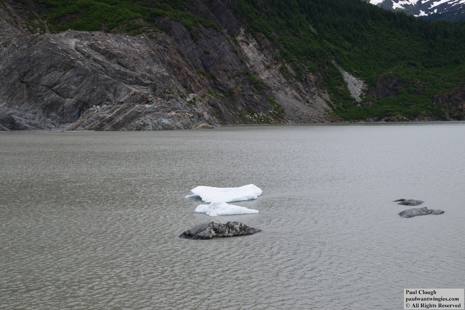
Pieces of ice from the Mendenhall Glacier floating in Mendenhall Lake

View of Mendenhall Glacier from the Visitors Center

W~~~~~~~~~~~~~~~~~~~~~~~~~~~~~~~~~~~~~~~~~~~~~~~
Visit my and subscribe to my youtube channel!
Visit my ETSY shop!

All photos taken by Paul Clough.  
© All Rights Reserved.  Please contact for permission to use photos.