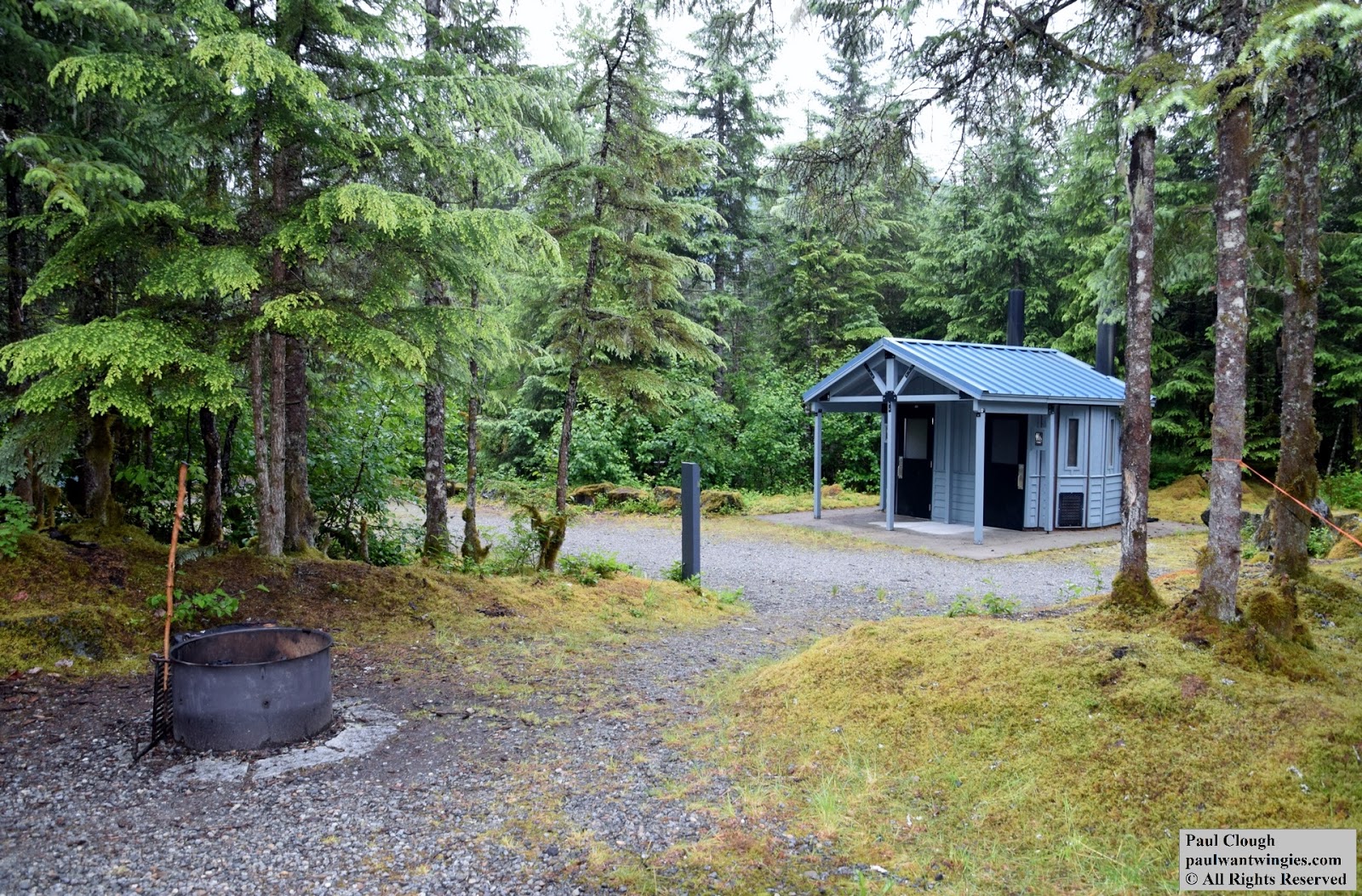
Site B29 at the Mendenhall Campground Backpacker Loop is towards the end of the loop. It seems to have an irregular tent pad compared to other sites. It is also fairly close proximity to site B28 but there's a little tree spacing. This site is nearest the water spigot so you may hear lots of foot traffic. This is in a low lying area so it can flood. There's typically pools of water near one or more sides so mosquitoes are more abundant.
Entrance to site B29 at Mendenhall Campground
View from tent pad of B29 at Mendenhall Campground
View of water on one side of B29 at Mendenhall Campground
Site B28 at the Mendenhall Campground Backpacker Loop is at the end of the loop. It's within direct sight of B27 so unless you're part of a group using both B27 and B28, it could be uncomfortable knowing B27 can look over at you all day. It's also very close to B29 but there's a tad more tree spacing. It's close to the river so the roar of the water could be a problem if the sound of water makes you pee.
Entrance to site B28 at Mendenhall Campground
View of B27 from B28 at Mendenhall Campground
View of main path from tent pad of B28 at Mendenhall Campground
View of water on one side of B28 at Mendenhall Campground
View from entrance to B28 at Mendenhall Campground
Site B27 at the Mendenhall Campground Backpacker Loop is at the end of the loop. It's within direct sight of B28 so unless you're part of a group using both B27 and B28, it could be uncomfortable knowing B28 can look over at you all day. It's close to the river so the roar of the water could be a problem if the sound of water makes you pee.
Entrance to site B27 at Mendenhall Campground
View towards B26 from B27 at Mendenhall Campground
View of river from B27 at Mendenhall Campground
View from tent pad of B27 at Mendenhall Campground
Site B26 at the Mendenhall Campground Backpacker Loop is towards the end of the loop. It's set back from the pathway so there's some privacy. It's close to the river so the roar of the water could be a problem if the sound of water makes you pee.
Entrance to site B26 at Mendenhall Campground
View from tent pad of B26 at Mendenhall Campground
Site B25 at the Mendenhall Campground Backpacker Loop is midway down the path. Traffic noise from the main road is minimal. You may occasionally hear the clanging of the trash bin lid. B25 is directly across from the restrooms so the clanging of the doors could be a problem. It is also open to the pathway which means anyone walking down the path can see into your site. B25 is also within site of B23 so your neighbor could see what you're doing somewhat. I spent 6 nights at this campsite and was fairly satisfied. I was pretty paranoid of bears so seeing people walk by every so often was pretty comporting as they would get mauled before me, theoretically.
Entrance to site B25 at Mendenhall Campground
View from tent pad of B25 at Mendenhall Campground
Site B24 at the Mendenhall Campground Backpacker Loop is close to the main road so the traffic noise could be bothersome. It is also next to the only trash bin in the area so the clanging of the lid could also be a concern. There's also an auto site behind but with some trees and spacing but a noisy group could bleed over. B24 is also near the restroom so the clanging doors could be an issue if crowded.
Entrance to site B24 at Mendenhall Campground
View from the tent pad of B24 at Mendenhall Campground
Site B23 at the Mendenhall Campground Backpacker Loop is nearest to the main road so the traffic noise could be bothersome. It is also across from the only trash bin in the area so the clanging of the lid could also be a concern. B23 is within sight of B25 so your neighbor can see what you're doing somewhat.
Entrance to site B23 at Mendenhall Campground
View of B23 from steps at Mendenhall Campground
View of neighboring site B25 from B23 at Mendenhall Campground
Picnic and fire ring at site B23 at Mendenhall Campground
The main entrance after you turn into the campground, about 750 feet from Montana Creek
Map of campground located at main entrance. Backpack loop is in red circle
The Mendenhall Campground located on the shores of the Mendenhall Lake provides a scenic view of the Mendenhall Glacier as well as the lake and surrounding Tongass National Forrest. Like most campgrounds, it's affordable compared to other lodging options. This page primarily covers the backpacker loop. All sites at this campground must be reserved and paid for in advance by visitinghttps://www.recreation.gov. You can view site availability and pay for your stay. There's a maximum of 14 nights per calendar year between Mendenhall Campground and Auk Village Campground. I spent 6 nights at site B25 in late June of 2017. It wasn't too crowded overall in the campground and usually only a couple other backpackers. One night I was the only one in the backpacker loop.
When you arrive, you go straight to your site. There's no check in. Rangers and or campground hosts do check the sites daily to ensure occupants have paid for their sites. You CANNOT pay in cash or otherwise arrive without prior reservations. Wood is not sold at the campground. You can buy it at most grocery, hardware and sporting goods stores. Occasionally people leave their spare wood in the wood sheds near the entrance or near the entrance to the backpacker loop but don't count on it as it goes fast when available.
Entrance to the backpacker loop
Close up of the sign leading to the backpacker loop
A proper campsite with fire
Camping essentials
Trash and wood shed located in the backpacker loop
Tent with rain tarp. It looks bad but worked fine.
There are 7 sites in the backpacker loop numbered B23 to B29. Each site provides a fire pit, a large wood picnic table and a tent pad.
There's a covered shelter/communal area located near the end of the loop. In times of rain, this is where most people in the backpacker loop will eat their meals. There's no fire ring so any food would have to be cooked on a camping stove (that you bring). There's two bear-proof storage boxes to share as well as a picnic table. It's near the water spigot and a short walk to the restrooms.
Covered communal shelter in the backpacker loop
Covered communal shelter in the backpacker loop
Bear-proof boxes in the covered communal shelter in the backpacker loop
The water spigot provides cold drinking water. It is located near the end of the loop on the right side of the shelter. There's also one at the entrance to the backpacker loop.
Water spigot in the backpacker loop
The restrooms are vault style which is just a fancy term for port-a-potty. But theses are nicer as they are permanent structures and quite roomy for changing clothes. There are no lights so when it's dark, you'll need a flashlight. Toilet paper is provided but like any good backpacker, it's always good to carry an emergency roll.
Restroom in the backpacker loop
Restroom in the backpacker loop
Unlike most USFS campgrounds, there are two shower houses, one near site 4 and one near site 46. Both sites also have flushing toilets and running water sinks. Men's have a urinal and a stall as well as two sinks while Woman's have two stalls and two sinks. Both showers have two stalls and adequate benches and hooks. All restrooms and showers are wheelchair accessible. The showers near site 46 are closet to the backpacker loop but were out of order on my visit (late June 2017). These showers and restrooms also have electrical outlets if you need to charge things. There are no electrical outlets in the backpacker or auto sites.
This is bear country! It's highly advisable to bring bear spray if you'll be spending a significant amount of time in Alaska.
If you don't have a vehicle, you'll need to store any food and products with scents like shampoo in a bear-proof container. Do not store them in your tent or leave out in the open. Campground hosts and rangers make daily rounds and will remove any items left unattended.
Like all USFS campgrounds unless otherwise posted, you can consume alcohol if you're 21 years of age but of course glass containers are frowned upon and drink in moderation. Although the usage of marijuana is legal in Alaska, the campgrounds and Tongass National Forrest are federal jurisdictions and as such follow federal regulations which means marijuana is not permitted.
Technically, even if you don't have a car, you can stay at an auto/tent site but all of these are along the main roads which will have less privacy as well as be noisier. The only advantage to booking an auto/tent site is more choices especially if all backpacking sites are booked.
Back in RV site at Mendenhall campground
Electrical hookup in the RV section at Mendenhall campground
Standard car site at the Mendenhall campground
Getting to and from the campground:
It's fairly easy to get to the campground if you don't have a car. Most people arrive by plane or ferry.
From the ferry terminal, it's a bit tricky as there are no buses that stop nearby. The nearest bus is about a mile and a half east of the terminal and there are no sidewalks or paths so you'll be walking on the shoulder. Not great. When you exit the terminal, the road is Glacier Highway. Walk east until you reach a traffic circle and turn left. You'll be on Mendenhall Loop. Cross the street and catch the route 4 on the UAA campus side of street. Get off at Mendenhall Loop and Montana Creek. It's about 3.5 miles so you could walk some more but that's up to you. Walking the whole way would be 5.1 miles. Even with the bus, you'll still be walking just over 2 miles. Of course, you can take Uber, Lyft or taxi.
From the airport, you could wait for the 5 or 6 express buses but you'll have to transfer at Nugget Mall. It's about a 10 minute walk to the mall. From the mall, look for the shelter with Valley on the top. Catch the 3 or 4. One goes clockwise and the other counter clockwise. The 4 would be a few minutes faster but I'd take whichever is next as they both run once an hour, making it every half hour. Again, you could also do the car share or taxi.
From the campground, I have posted a photo of the times below. Note that the buses do not operate on holidays and Sunday has reduced service. You can catch either the 3 or 4 as they both go downtown. Once they get to Nugget mall, they follow the same route. The nearest full service grocery store is Safeway but the way the bus runs, you have to get off about 2 or 3 blocks away. It's also a pain getting back to the bus if you have lots of stuff. You could also stay on the bus pass Nugget mall and go to Fred Meyer. This is probably the best option as they have a full service grocery store as well as home goods and camping supplies. If you want a full service outdoors shop, Sportsman's Warehouse at Nugget Mall is probably your best option. If you want to go downtown, you can transfer to the express bus 5 or 6 at Nugget mall and shave 20 minutes off the trip.
The bus fare is $2 each way and you can transfer between express and local. Just tell the next driver you transferred. It's old fashioned. Also, there are no day passes so if you'll be in town awhile and think you'll ride a lot, you might consider getting tokens from downtown library or Fred Meyer.
Also, if you plan on visiting the Mendenhall Visitor's center, it's about 4 miles or you can shave 2 miles off on the bus.
Alaska Airlines Elite Status and delay compensation
In a time when it seems like every airline is trying to punish the passenger for having the audacity to fly with them, Alaska Airlines seems to be one bucking the trend. Last year was rather busy for me and I earned the lowest elite status with American Airlines, Gold. While that was nice, they quickly changed the mileage earning scheme to the revenue based model like United and Delta had a few years before. However, my love for visiting Alaska had me flying on Alaska Airlines more and getting the significantly reduced miles using my AAdvantage really felt like I was being cheated since Alaska is really far away.
I had heard that Alaska Airline Mileage Plan matched status with certain airline mileage programs so I decided to give it a shot. Using the info found on thepointsguy, I emailed the department the required information and about two weeks later, was granted MVP status. I had the lowest tier of AAvantage so I got the lowest tier of Mileage Plan. But it was moot as I had to delay my next Alaska trip for a few weeks and ended up flying on another airline.
By the time I got around to flying on Alaska Airlines, it was a short hop from Juneau to Anchorage via the famed milk run Flight 65 which runs from Seattle to Ketchikan to Wrangell to Petersburg to Juneau to Anchorage. I booked the ticket a week before departure.
I was camping at the Mendenhall Campground but happened to be at the Safeway 24 hours before departure so I used the wifi to check into my flight via the app. The next day, I arrived to the Juneau airport to check in and was delighted to find I was upgraded to First. With Alaska, you don't have to worry about segments and how long the flight is. You either get an upgrade or you don't. I proceeded to security and got up to the departure lounge to find that the flight was running a half hour behind. No big deal. But by the time I came out the bathroom five minutes later, the delay ballooned to 3 hours! Apparently there was a mechanical problem with the plane in Petersburg. I went to the bar and had a few drinks and a pizza and returned to the gate area to find the flight was still 3 hours delayed. They asked if anyone had not gotten their meal voucher and I was like, ME!
As this was an issue within the airline's control, Alaska offered a $12 meal voucher which could be used at the restaurants at the airport or two locations off airport grounds. The two restaurants were about a 10 minute walk from the airport. I opted to stay at the airport as I did not want to go through security again. About 30 minutes before the estimated departure time, I redeemed my voucher for a salad. If you've been to Alaska, $12 does not go far, haha! Hoping to begin boarding soon, I was informed the plane was still on the ground in Petersburg but was getting ready to leave.
After a four and a half hour delay, the plane finally arrived. After a rather quick turnaround, I boarded with the First class passengers and settled into 1A. The new departure time rolled around and more bad news came in. Apparently a door seal problem. After another 30 minutes, the front door was finally shut and we headed to the runway. Or so we thought. The plane paused before the runaway and the captain came over the intercom to inform us there was now a flap problem and we would be returning to the gate. When it rains, it pours.
So back at the gate, many passengers were quite despondent about their connections and wished to try for the next two departures. Probably half the passengers deplaned in hopes of snagging a seat on the two remaining flights of the day. I however was not in a hurry as were most of the First class passengers. The guy behind me asked if there was a meal and the flight attendant served most their snack. I opted to wait until we got in the air but enjoyed a nice Jack on the rocks while we awaited further news. After an hour, the plane was given the all clear and we proceeded back to the runway. Finally, we were airborne and on our way for the short 90 minute flight.
Once in the air, I had another Jack and my snack. I was quite surprised at the quality of the "snack" as opposed to a snack (bag of chips or nuts) on any other airline I flown First on for much longer flights. Basically, a charcuterie plate with pastrami, cheese, olives and bread with mustard spread. While small, it was defiantly filling after eating pizza and salad waiting out the delay. A final Jack and we were on final approach to Anchorage.
What was supposed to be a 3:15 PM arrival turned into a 10:00 PM arrival. I was just happy to arrive at all and headed to my lodging. I received an email apologizing for the delay and was promised a $150 discount for a future flight. The next day, the discount code came and it was for $200. I am quite impressed that not only did Alaska Airlines keep me well posted along the delay but that they also offered the meal voucher AND $200 in credit. I have been delayed for similar reasons on other airlines and was lucky to get rebooked and a sorry. While I can't guarantee you'll be treated the same if you're delayed with Alaska, they have definitely earned my future business and I hope they can resist the notion to conform and keep their mileage plan... a mileage plan.
Note that discount does not cover taxes and airport fees so even if the ticket costs less than the value, you'll still have to pay something. But still a good deal as it's a discount that you otherwise wouldn't have.
Whether you've had Alaskan Brewing Co beer at home (you can find it in 19 states) or you had it on your cruise ship or vacation in Alaska, chances are you're a fan and would like to learn more about the company. If you happen to visit Juneau, you can visit the brewery and participate in a beer tasting. It's not a tour per se, sort of along the lines as Samuel Adams in Boston but more of a history along with several samples.
The brewery is located at 5429 Shaune Drive which is in the Lemon Creek area, between Juneau and Auke Bay. You can get to it by local bus 3 or 4 from downtown or Auke Bay or you can take a shuttle from the Alaskan Brewery Depot (gift shop, no beer) at 219 S. Franklin Street for $20. It's still $20 if you get there on your own accord so whatever is most convenient for you.
Tastings start at the top of the hour and last about 35 to 40 minutes. Most people come through the shuttle but some are walk ins. You'll be ushered into the private tasting room which was part of the original brewery. A brewer will give you a history of the brewery, how it started and how it got to where it is today while serving you three 4 ounce samples of the most popular brews. Upon conclusion, you'll receive four bottle caps which entitle you to four more samples in the taproom which is the main room and gift shop. You'll be able to try common brews to limited runs and even rough drafts which are not commercially available. Also, if they have mystery beers, those are available without using your precious bottle caps.
All said and done, you'll get up seven 4 ounce pours plus maybe a bonus or two if there are mystery taps. That's roughly 2 and a half pints and depending on where you go, you'd spend that much anyhow but would miss out on the informative history. I enjoyed my tasting and got out of my comfort zone of Alaskan White. They had a smoked porter which I will have to look for when I get back to Texas. A few people were in a rush to get back on their shuttles and I ended up with a few extra bottle caps which make a nice souvenir. Or maybe I used them.. Muhahahaha!
You can also buy souvenirs, get your growler filled, buy cases of beer and kegs (if you'll be in town awhile).
This is a popular and inexpensive actively for cruise ship passengers and fits in well with the schedules. Visit their site for more information, hours and to see if you can buy their beer where you live.
During the summer, it's open 7 days a week but closed on Sundays during the winter.
There are some other tour groups that include this tasting as well in their packages so you might couple this with other popular attractions such as the Mount Roberts Tram, a whale watching tour or Mendenhall visitor's center.
This is also a great stop if you're in an RV and need to stop by Costco which is nearby.
View of Mendenhall Glacier from the Mendenhall Campground
I was planning on hiking
the West Glacier Trail but not necessarily to the ice caves which I
did not even know about until someone at my campground mentioned it
and asked if I would join her. Since hiking in groups is
greatly advisable, I was happy to have some company. I made
sure I had some food, water, bear spray and my camera.
We walked to the West
Glacier Trailhead which is accessed by Montana Creek road which will
turn into Skaters Cabin road. This is about a mile from the
main road, Mendenhall Loop road. The first mile or so is easy
walking. Then you do a little elevation gain with a few
switchbacks and cable hand rails. At around the second mile,
you reach a fork with straight being the West Glacier and right
being the View Point Trail, (this is not a "View Point" like I had
thought, I'll come back to this later). So we continued up the
West Glacier Trail which started getting more mountainy and required
some careful stepping and the occasional butt slides. There
was one steep rock face which had a knotted rope to help you up.
We were looking for the
so called ice cave trail which we asked returning hikers about.
One said it didn't exist while two others said we were on the old
ice cave trail with no access to the so called new caves. But
then we ran into a group that said this trail does in fact go to the
ice caves. So we continued on. However, after about 3
hours, we got to some really steep and hard to navigate terrain and
my hiking companion decided she did not want to go down something
she couldn't get back up. We were about a half hour away
according to the last group we talked to. So she was going to
wait while I continued on. From the point I left her, I
crossed a creek by a plank made of two 2x4s. From there, it
was following these plastic tape like markers tied to trees or
bushes. I believe these we installed by the guided tours which
I would HIGHLY recommend using!
As I got closer, the air
got much cooler as the glacier cools the air as much as 10 degrees
within a mile. Every so often, I could see the glacier,
getting bigger and bigger. By this point, it was mostly rock
faces carved out by the receding ice. Somewhere along the way,
I lost track of the markers but I could see the glacier so against
my better judgment, I continued on. I did see some markers but
they seemed to be loose and perhaps not in their original spots.
But at long last, I came to a very steep loose rock and gravel
embankment which lead to the ice caves. There wasn't any way
down but straight down that I could see so I carefully slide down
and made it to the shoreline. So, getting there was not too
difficult but the intended trail was not well marked in my opinion.
This could be for a variety of reasons. I think the forest
service doesn't necessarily want tons of people hiking there,
especially without a guide. As with any back country hiking
(or any activity in a forest service area), it's at your own risk.
As for the ice caves,
they were truly astounding. I know some of my photos makes
them look small but they are large. Some of my pics have
people in them to give you an ideal on how big it is. As for
going in, that is totally at your own risk. I did see a guided
group but they had all the necessary safety equipment. But I
kind figured if the ice caved in, a hard hat wasn't going to do much
so again, against my better judgment, I walked through the largest
cave which is more of a tunnel as it goes through to the backside of
this portion of the glacier. From the back side, you can see
the other caves which had much lower ceilings. The blue ice
was just beautiful. This is the product of hundreds of year's
snow compacting into ice and is now melting away.
If you do venture in,
make sure there are other people around and you have a waterproof
phone and or camera cover. It's like a light drizzle inside
all of the caves. Looking at some of the ice has an
otherworldly feel to it. Like nothing you'll see anywhere
else. Again, I stress that these are ice caves and completely
unpredictable. They will be gone soon (several months to a few
years?) but more caves will reveal themselves so it's an ever
changing landscape.
After I took many photos,
I chatted with someone about the trails and thought I was getting
put back on the right track but there are apparently two trails.
I was hiking this other trail and soon realized I was not where I
should be. I needed to get back to where I left my hiking
companion so I idiotically went off trail in hopes of intersecting
the other trail. This turned out to be fruitless and I spent
an hour making no progress. I ended up slipping and falling,
road rashing my hand and elbow and decided I really needed some
help. I was in a lower point and realized I was near a
landmark (receding ice timeline marker) so that would be at least
some useful information if I needed to call the ranger.
I eventually saw another
group and was able to meet up with them, explain my situation and
they had a first aid kit to cover up my wounds. They said we
were on a sort of unofficial trail but basically the view point
trail and recommended that I hike with them back to the trailhead
and I could go from there. This other trail was equally up and
down terrain wise so there's definitely not an easy trail to the
glacier. When we returned to the fork, I recognized that I
wasn't too far from the point I left and was ready to head back out
when lo and behold, there she was coming down the trail. This
was of course a relief to all of us as it had been about three hours
since we split up. She just figured I was having a great time
and started heading back. It all worked out. But I know
made several stupid mistakes!
First and foremost, I
should have got her phone number before we split up. That was
dumb. Secondly, I should have had an actual topographical map
of the area, not just a squiggly line that I screenshotted from an
app which provided absolutely no detail. I had rudimentary gps
on my phone so I had a decent idea but that's still not a substitute
for factual information. Thirdly, I didn't have hiking boots
on which definitely contributed to my fall. And lastly, I
continued on when I wasn't sure. As soon as I lost the trail,
I should have backtracked. I was in the boy scouts so I knew
better.
While this was an
incredible experience, I would not do it again without an
experienced guide or at the very least, kayaking across the lake as
that puts you a quarter mile away with an easy to follow trail.
But this information changes as the ice continues to recede so
again, go with someone who has been there recently.
Along with pictures from
the campground, the Mendenhall Visitors Center and Nugget Falls, I
have seen the glacier from many viewpoints over six days and find
the Mendenhall Glacier to be an absolute must visit if you come to
Juneau.
About a quarter
mile to the Mendenhall Glacier Ice Caves
Looking down a
rock a gravel embankment to the Mendenhall Glacier Ice
Caves (lower center)
A closer view of
the entrances to the Mendenhall Glacier Ice Caves (note the
people)
The main
cave/tunnel at Mendenhall Glacier Ice Caves
Smaller opening
at Mendenhall Glacier Ice Caves (note the backpack and legs
inside)
Mendenhall
Glacier Ice Caves melting (way to wet to go into)
Mendenhall
Glacier Ice Caves main opening (looks small from this angle
but it's not!)
Inside one of the
Mendenhall Glacier Ice Caves
Inside one of the
Mendenhall Glacier Ice Caves
On top of the
Mendenhall Glacier Ice Caves (lots of loose rocks)
View from behind
the Mendenhall Glacier Ice Caves
View from behind
the Mendenhall Glacier Ice Caves
Under the
Mendenhall Glacier Ice Caves
Under the
Mendenhall Glacier Ice Caves
Under the
Mendenhall Glacier Ice Caves
Behind the
Mendenhall Glacier Ice Caves
Close up view under the Mendenhall Glacier Ice Caves
A chunk of ice at the Mendenhall Glacier Ice Caves
Another close up view under the Mendenhall Glacier Ice Caves
(the color is right, this wasn't as aqua as other parts of the caves)
Better view of
the Mendenhall Glacier Ice Caves openings
Wide view of the
Mendenhall Glacier Ice Caves openings
Hikers on top of Mendenhall Glacier Ice Caves
Close up of hikers on top of Mendenhall Glacier Ice Caves
Wide view of the front of Mendenhall Glacier
Close up of the crevices in the Mendenhall Glacier
Super zoom of crevice in Mendenhall Glacier
Mendenhall
Glacier Ice Limit Marker from 2002 (unfortunately the sign was facing the opposite direction of the glacier so it's hard to see how far away it was but it was maybe a third of a mile)
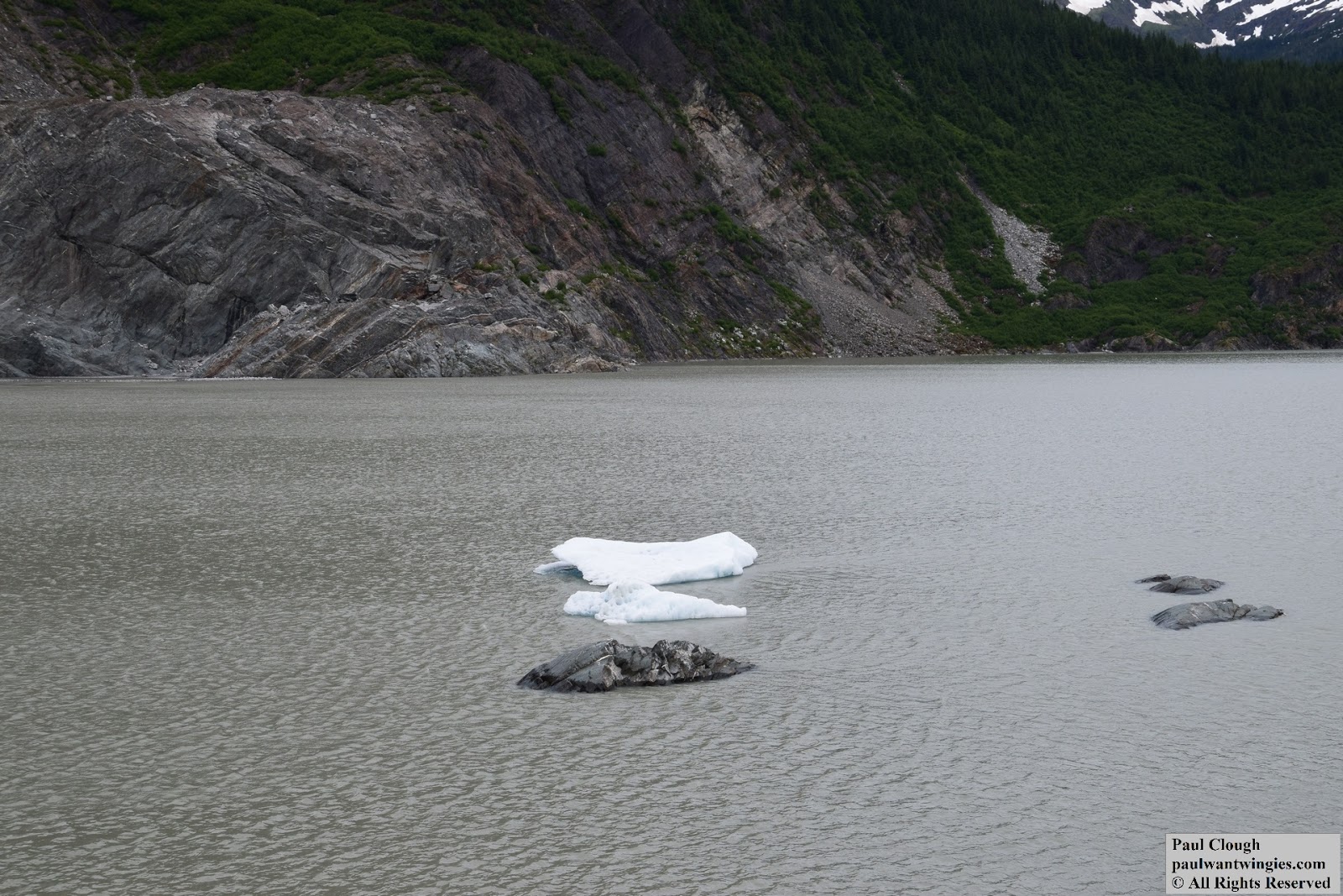
Pieces of ice from the Mendenhall Glacier floating in Mendenhall Lake
View of Mendenhall Glacier from the Visitors Center